9 ORB_SLAM2_Octomap
9 ORB_SLAM2_Octomap 9.1 Introduction 9.2 Use 9.3 octomap_server 9.3.1 Topics and Services 9.3.2 Configuration parameters 9.3.3 TF transformation 9.4 Extended test
octomap official website: http://octomap.github.io/
octomap source code: https://github.com/OctoMap/octomap
octomap wiki: http://wiki.ros.org/octomap
octomap_server: http://wiki.ros.org/octomap_server
9.1 Introduction
Octomap uses an octree data structure to store probabilistic occupancy maps of 3D environments. The OctoMap library implements a 3D occupancy grid mapping method, provides data structures and mapping algorithms in C++, and is especially suitable for robots. The map implementation is based on octrees.
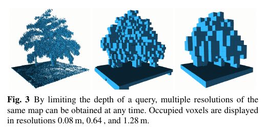
It compresses, updates the map elegantly, and has adjustable resolution!It stores the map in the form of an octotree(described later), which saves a lot of space compared to point clouds. The map created by octomap looks like this:(different resolutions from left to right)
- Precautions
Note: When building a map, moving the robot slowly and losing keyframes may cause the map to fail.
According to different models, you only need to set the purchased model in [.bashrc], X1(ordinary four-wheel drive) X3(Mike wheel) X3plus(Mike wheel mechanical arm) R2(Ackerman differential) and so on. Section takes X3 as an example
Open the [.bashrc] file
sudo vim .bashrc
Find the [ROBOT_TYPE] parameter and modify the corresponding model
xxxxxxxxxxexport ROBOT_TYPE=X3 # ROBOT_TYPE: X1 X3 X3plus R2 X7
9.2 Use
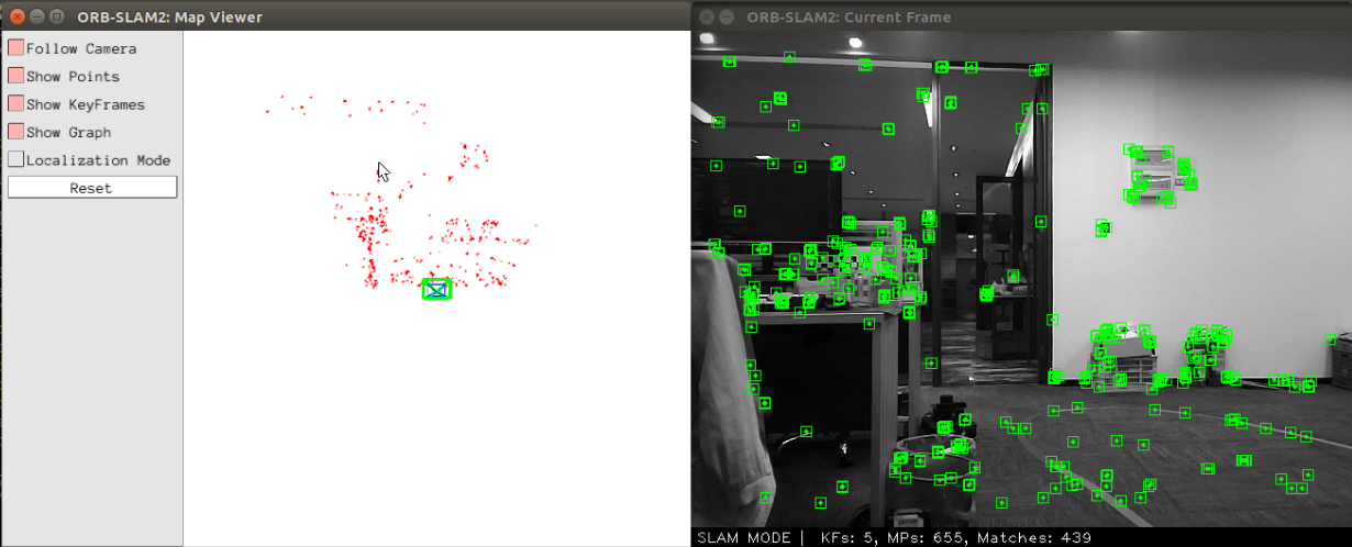
Start orb_slam and the underlying driver(Robot side)
xxxxxxxxxxroslaunch yahboomcar_slam robot_orb_slam.launch bUseViewer:=true
- [bUseViewer] parameter: whether to open the visualization window of orbslam. If true, you can clearly view the key points. If the positioning is unsuccessful, you can reset the key points. Click [Reset] on the left side of the figure below.
Start octree mapping(Robot side)
xxxxxxxxxxroslaunch yahboomcar_slam robot_orb_octomap.launch frame_id:=odom use_rviz:=false
- [frame_id] parameter: coordinate system name, available by default without setting.
- [use_rviz] parameter: whether to enable rviz.
Open the visual interface(virtual machine side)
xxxxxxxxxxroslaunch yahboomcar_slam view_orb_octomap.launch
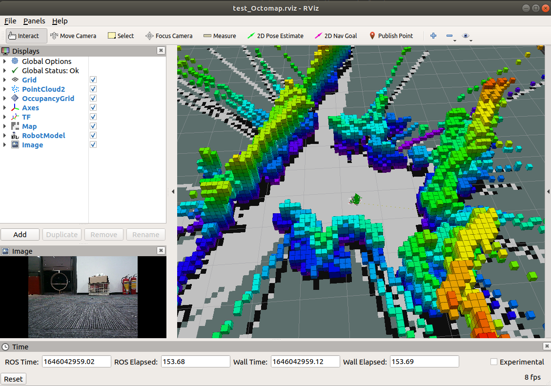
Because of the octree, its map looks like a lot of small blocks(much like minecraft). When the resolution is high, the square is small; when the resolution is low, the square is large. Each square represents the probability that the square is occupied.
9.3 octomap_server
9.3.1 Topics and Services
| Subscribe to topics | type | describe |
|---|---|---|
| cloud_in | sensor_msgs/PointCloud2 | Incoming 3D point cloud for scan integration. |
| Post a topic | type | describe |
| octomap_binary | octomap_msgs/Octomap | The complete maximum-likelihood occupancy map is a compact octal-mapped binary stream, encoding free space and occupancy space. Binary messages only differentiate between free space and occupied space, but smaller. |
| octomap_full | octomap_msgs/Octomap | The complete maximum-likelihood occupancy map is a compact octal-mapped binary stream, encoding free space and occupancy space. The complete message contains the complete probability and all additional data stored in the tree. |
| occupied_cells_vis_array | visualization_msgs/MarkerArray | In RViz, all occupied voxels are marked as "boxes" for visualization |
| octomap_point_cloud_centers | sensor_msgs/PointCloud2 | The centers of all occupied voxels serve as a point cloud, useful for visualization. Note that this will have gaps because points have no volume size and octagonal voxels can have different resolutions! |
| map | nav_msgs/OccupancyGrid | Project a 2D occupancy map down from a 3D map. |
| Serve | type | describe |
| octomap_binary | octomap_msgs/GetOctomap | The complete maximum-likelihood occupancy map is a compact octal-mapped binary stream, encoding free space and occupancy space. |
| clear_bbx | octomap_msgs/BoundingBoxQuery | Clear the area in the 3D occupancy map, set all voxels in that area to "free" |
| reset | std_srvs/Empty | reset the entire map |
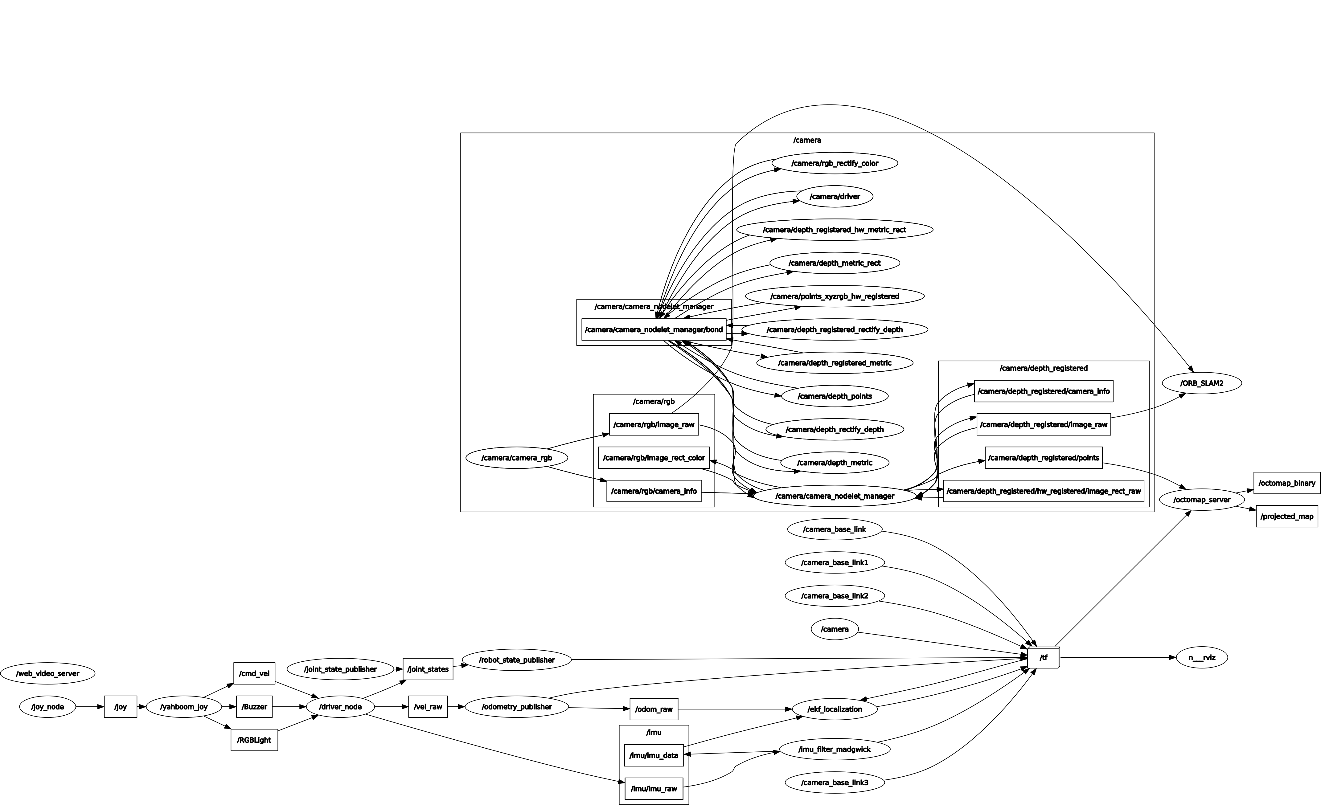
Node view
xxxxxxxxxxrqt_graph
9.3.2 Configuration parameters
| parameter | type | Defaults | describe |
|---|---|---|---|
| frame_id | string | /map | The static global frame in which the map will be published. When building the map dynamically, the sensor data needs to be converted to this frame. |
| resolution | float | 0.05 | The resolution of the map(in meters) when starting from an empty map. Otherwise the resolution of the loaded file will be used. |
| base_frame_id | string | base_footprint | Robot pedestal for ground plane detection(if enabled) |
| height_map | bool | true | Should the visualization encode the height in a different color |
| color/[r/g/b/a] | float | When ~heigh_map=False, display the color of occupied cells in the [0:1] range | |
| sensor_model/max_range | float | -1(unlimited) | The maximum extent(in meters) to insert point cloud data when building a map dynamically. Limiting the range to a useful range(e.g. 5 meters) prevents false false points away from the robot. |
| sensor_model/[hit | miss] | float | 0.7/0.4 | Hit and miss probabilities in sensor models when building maps dynamically |
| sensor_model/[min | max] | float | 0.12/0.97 | Clamping min and max probabilities when building maps dynamically |
| latch | bool | True for static mapping, false if no initial mapping is given | Whether the topic is locked for publication or only published once per change. For best performance when building maps(frequently updated), set this to false. When set to true, all changes on every map will create all themes and visualizations. |
| filter_ground | bool | false | Whether the ground plane should be detected and ignored from scan data when building the map dynamically using pcl::SACMODEL_vertical_plane. This clears everything on the ground, but doesn't insert the ground into the map as an obstacle. If this feature is enabled, the ~ground_filter/... parameter can be further configured. |
| ground_filter/distance | float | 0.04 | Distance threshold of the point(z direction) to split to the ground plane |
| ground_filter/angle | float | 0.15 | The angle threshold between the detected plane and the horizontal plane detected as the ground |
| ground_filter/plane_distance | float | 0.07 | Distance threshold for distance z=0 for planes to be detected as ground(fourth coefficient of PCL plane equation) |
| pointcloud [min | max] z | float | -/+ infinity | Insert the minimum and maximum heights to be considered in the callback. |
| occupancy [min | max] z | float | -/+ infinity | Minimum and maximum heights to consider in the final map. |
9.3.3 TF transformation
| Required TF Transform | describe |
|---|---|
| sensor data frame --> /map | For scan integration, the sensor data needs to be converted into a global map frame. This information needs to be obtained from an external SLAM or localized node. |
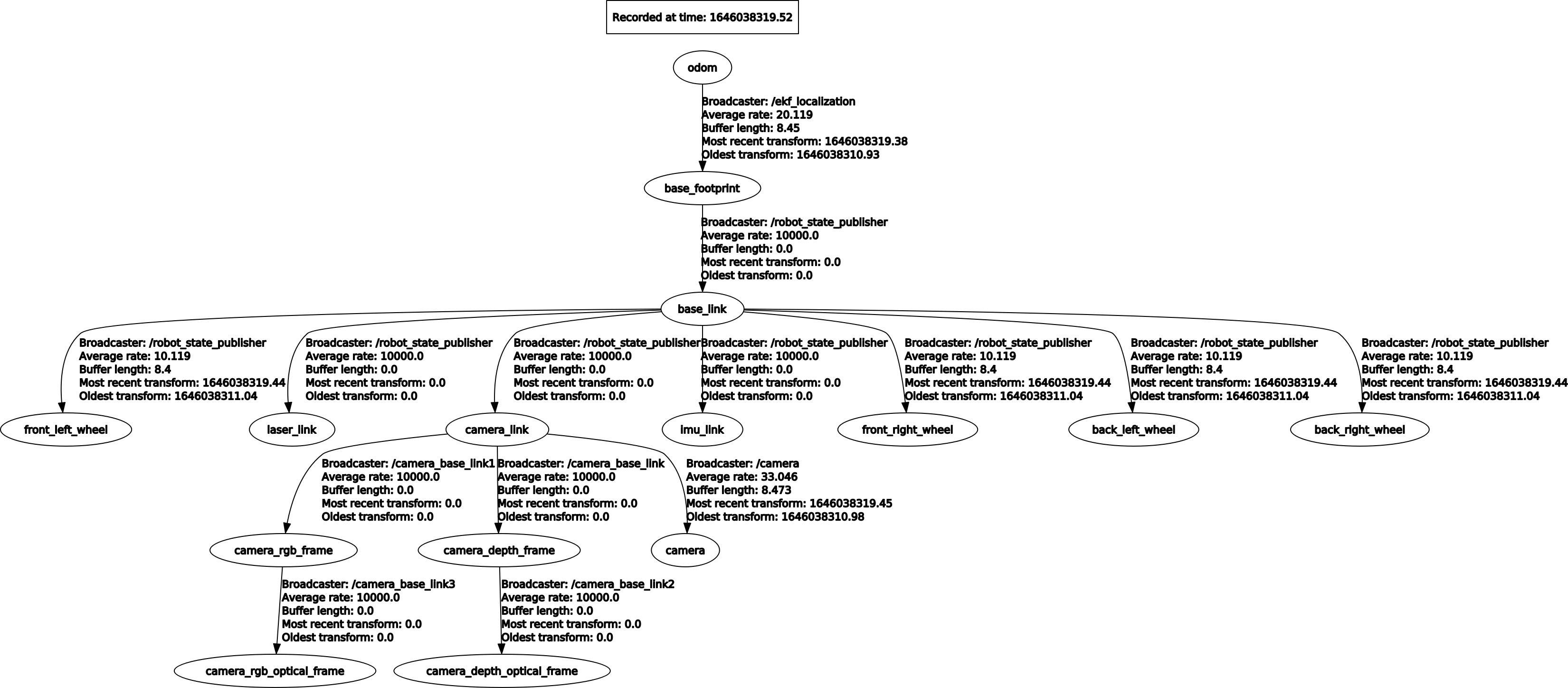
View tf tree
xxxxxxxxxxrosrun rqt_tf_tree rqt_tf_tree
9.4 Extended test
Note: This case belongs to the test version and is related to the performance of the device. If the performance is too low, it may not start normally.
Start the underlying driver +orb_slam(virtual machine side)
xxxxxxxxxxroslaunch yahboomcar_slam test_orb_slam.launch
- [bUseViewer] parameter: whether to open the visualization window of orbslam.
Start octree mapping(virtual machine side)
xxxxxxxxxxroslaunch yahboomcar_slam test_pcl_mapping.launch
- [use_viewer] parameter: whether to open the visualization window of pcl_viewer.
- [local_frame_id] parameter: local map coordinate system.
- [global_frame_id] parameter: global map coordinate system.
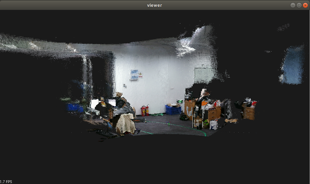
After opening, the [viewer] window will pop up, as shown below
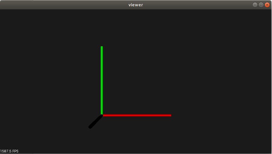
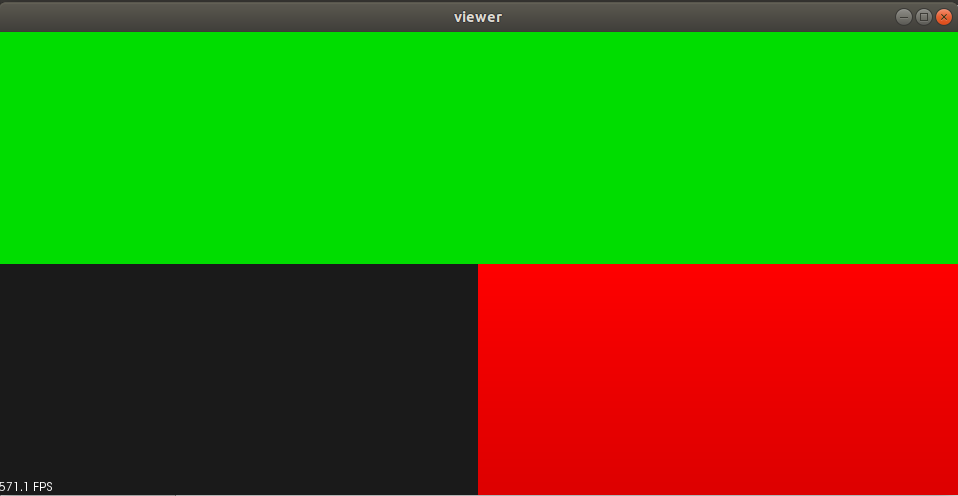
Move the camera slowly, when a picture appears, as shown below
You need to scale and rotate the coordinate system as shown below
Scroll wheel: zoom in and out
Press and hold the scroll wheel: pan
Left mouse button: rotate
Right mouse button: zoom in and out
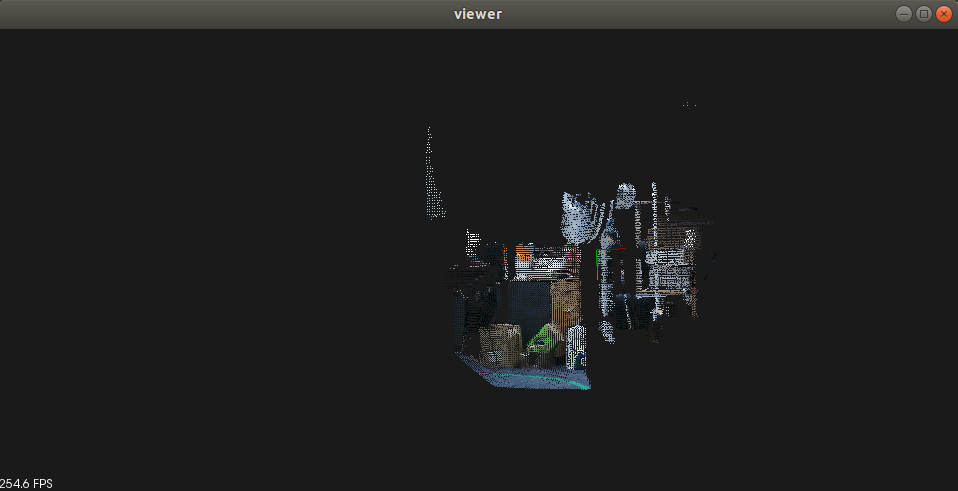
Slowly move the camera to build the map as shown below. After the construction is completed, [Ctrl+c] closes, and the pcd point cloud file is automatically saved. The file name of the path under this function package is [resultPointCloudFile.pcd]
pcl_viewer installation command
xxxxxxxxxxsudo apt-get install pcl-tools
View, enter the directory where the pcd file is located
xxxxxxxxxxpcl_viewer resultPointCloudFile.pcd