Welcome to T-mini Plus LiDAR repository
2.Handheld lidar mapping
2. Handheld lidar mapping
It is recommended to directly use the virtual machine or Raspberry Pi 5 image we provide, because it may not run due to environmental differences
1. Install dependent libraries, take the ros-melodic version as an example, enter in the terminal,
sudo apt install ros-melodic-moveit ros-melodic-moveit-visual-tools ros-melodic-kdl-* ros-melodic-joint-state-publisher-gui ros-melodic-trac-ik liborocos-kdl-dev ros-melodic -teleop-twist-keyboard ros-melodic-moveit-resources ros-melodic-navigation ros-melodic-gmapping ros-melodic-hector-slam ros-melodic-slam-karto ros-melodic-robot-state-publisher ros-melodic- geographic-msgs ros-melodic-libuvc-* ros-melodic-rtabmap-ros libavformat-dev libavcodec-dev libswresample-dev libswscale-dev libavutil-dev libsdl1.2-dev ros-melodic-pointcloud-to-laserscan ros-melodic- mbf-msgs ros-melodic-mbf-costmap-core ros-melodic-costmap-converter ros-melodic-bfl ros-melodic-serial ros-melodic-teleop-twist-joy ros-melodic-laser-proc ros-melodic-rosserial -arduino ros-melodic-rosserial-python ros-melodic-rosserial-server ros-melodic-rosserial-client ros-melodic-rosserial-msgs ros-melodic-amcl ros-melodic-map-server ros-melodic-urdf ros-melodic -xacro ros-melodic-interactive-markers ros-melodic-octomap* ros-melodic-joy* ros-melodic-dwa-local-planner ros-melodic-multirobot-map-merge python-catkin-tools python3-dev python3-catkin -pkg-modules python3-numpy python3-yaml build-essential ros-melodic-imu-tools ros-melodic-cartographer*
2. Start the mapping command
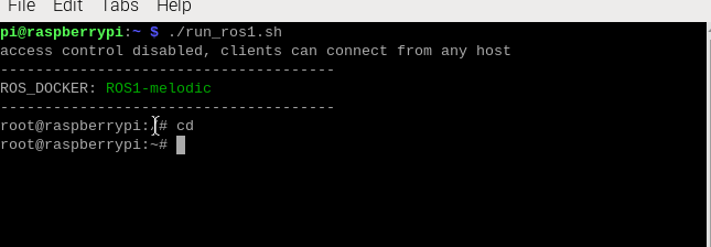
First go into the docker we provide, open a terminal in the Raspberry Pi directory and enter,
xxxxxxxxxx./run_ros1.sh
Take gmapping mapping as an example, enter in the terminal,
xxxxxxxxxxroslaunch oradar_lidar test_gmapping.launchIt is normal for this error to appear at the beginning of running the program, because the tf conversion was not converted at the beginning, but was converted later.
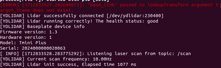
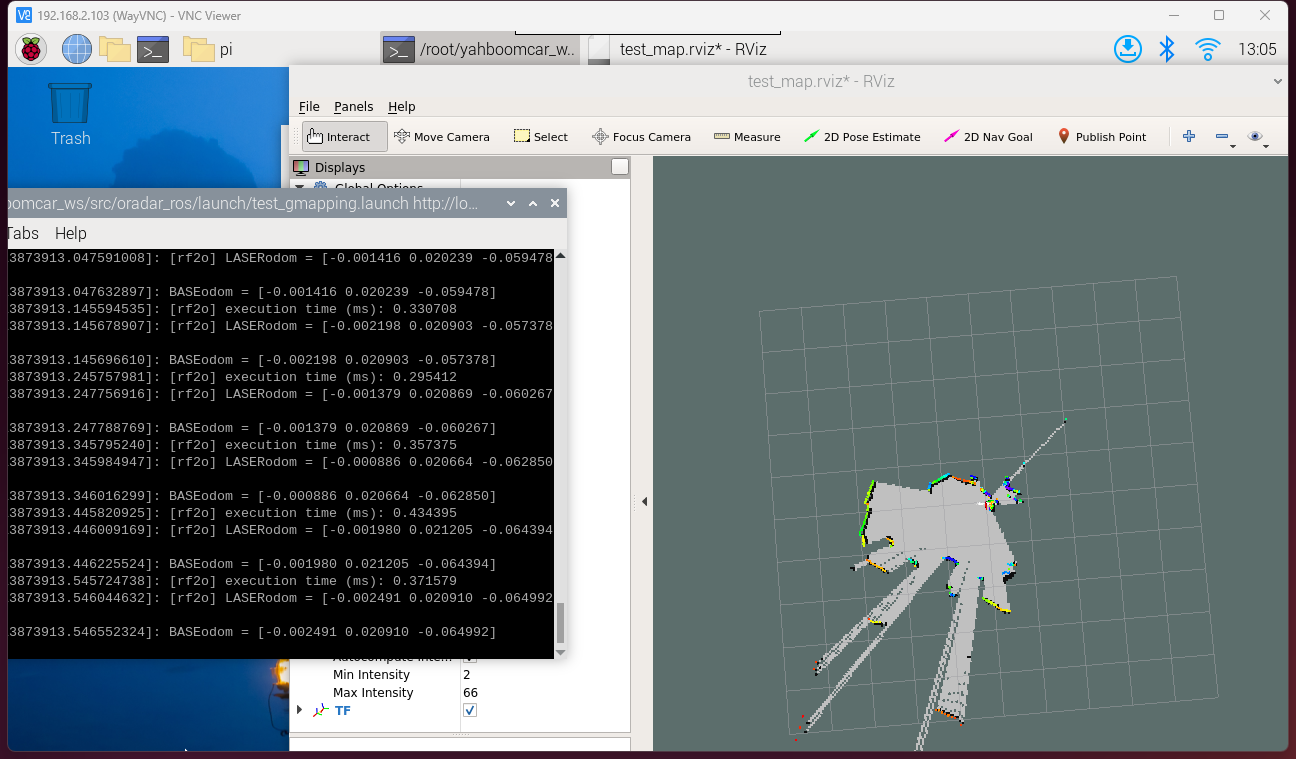
The following screen appears, indicating successful operation.
3. Save the map
Taking gmapping as an example, the map saving command is,
xxxxxxxxxxrosrun map_server map_saver -f ~/yahboomcar_ws/src/oradar_ros/maps/map
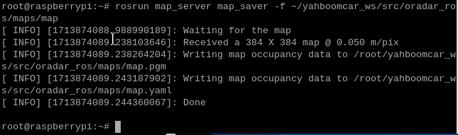
The map will be saved to the ~/ydlidar_ws/src/oradar_ros/maps/ folder, a pgm image and a yaml file.
map.yaml
ximage/home/yahboom/yahboomcar_ws/src/oradar_ros/maps/map.pgmresolution0.050000origin-10.000000 -10.000000 0.000000Negate0occupied_thresh0.65free_thresh0.196Parameter analysis:
image: The path of the map file, which can be an absolute path or a relative path.
resolution: resolution of the map, meters/pixel
Origin: 2D pose (x, y, yaw) in the lower left corner of the map. The yaw here is rotated counterclockwise (yaw=0 means no rotation
change). Many parts of the current system ignore the yaw value.
negate: whether to reverse the meaning of white/black and free/occupied (the interpretation of the threshold is not affected)
occupied_thresh: Pixels with an occupation probability greater than this threshold will be considered fully occupied.
free_thresh: Pixels with occupancy probability less than this threshold will be considered completely free.
4. View relevant information
View tf tree
xxxxxxxxxxrosrun rqt_tf_tree rqt_tf_tree
Node communication view
xxxxxxxxxxrosrun rqt_graph rqt_graph
5. Algorithm information reference website
5.1. Graphing algorithm
Gmapping: http://wiki.ros.org/gmapping/
hector_slam: http://wiki.ros.org/hector_slam
hector_slam/Tutorials: http://wiki.ros.org/hector_slam/Tutorials/SettingUpForYourRobot
hector_mapping: http://wiki.ros.org/hector_mapping
karto: http://wiki.ros.org/slam_karto
Cartographer: https://google-cartographer.readthedocs.io/en/latest/
Cartographer ROS: https://google-cartographer-ros.readthedocs.io/en/latest/
5.2. Independent map navigation
rrt_exploration: http://wiki.ros.org/rrt_exploration
rrt_exploration/Tutorials: http://wiki.ros.org/rrt_exploration/Tutorials
5.3. Save the map
map_server: https://wiki.ros.org/map_server