Welcome to ROSMASTER A1 PRO repository
6.Cartographer-SLAM Mapping
🗺️ Cartographer-SLAM Mapping
1. Course Content
Master using Google Cartographer algorithm for 2D laser SLAM mapping.
Master remote controlling the robot for mapping and viewing submap and global loop closure optimization effects in RViz2.
Master methods for saving standard OccupancyGrid raster maps (
.yaml+.pgm) and Cartographer pose graph state files (.pbstream).
2. Cartographer Introduction
Cartographer is a 2D/3D SLAM system open-sourced by Google based on Graph-based SLAM framework:
Submap Construction (Front-End): Continuous multiple frames of LaserScan laser data are inserted through correlative scan matching (CSM) to construct local Submap submaps.
Loop Closure Detection and Back-End Optimization (Back-End): When the number of constructed submaps increases, the back-end performs loop closure constraint solving (Loop Closure) multi-threaded via Ceres solver, eliminating accumulated drift from odometry and scan matching.
Features and Advantages: Extremely high mapping accuracy, strong loop closure correction ability, supports building highly consistent maps in large-scale indoor complex environments.
3. Preparation and Running
This example requires opening 3~4 terminals to start the following nodes in sequence:
3.1 Start Cartographer Mapping Node
Run in Terminal 1 (automatically starts chassis driver, lidar driver, and Cartographer mapping core):
ros2 launch yahboomcar_nav map_cartographer_launch.py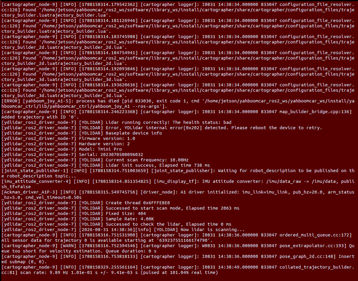
3.2 Start RViz Map Visualization
Run in Terminal 2 (it is recommended to open RViz on the virtual machine if the VM and robot are on the same LAN):
xxxxxxxxxxros2 launch yahboomcar_nav display_map_launch.py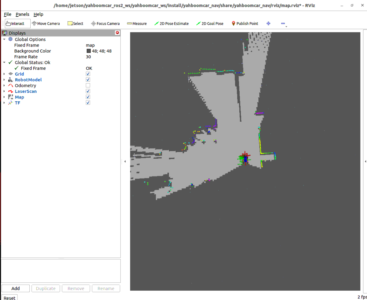
3.3 Start Keyboard Control to Move Robot for Mapping
Run in Terminal 3 the keyboard control node:
xxxxxxxxxxros2 run yahboomcar_ctrl yahboom_keyboard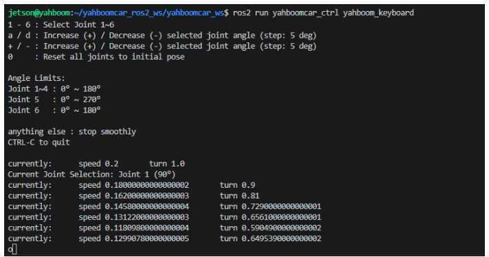
3.4 Mapping Operation and Map Save Instructions
Mapping Driving Suggestions:
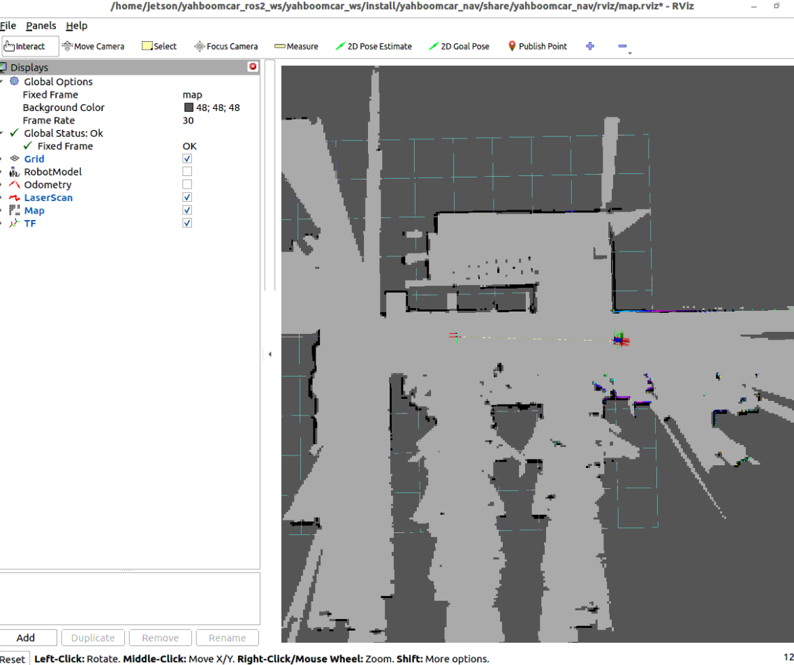
Remote control the robot to slowly and smoothly drive through the entire environment, observe the continuous splicing of submaps in RViz.
When completing a loop back to the starting origin, the back-end will automatically match historical submaps and trigger global loop closure optimization, instantly eliminating corridor accumulated drift.
Save 2D Raster Map (.yaml + .pgm): Run the map save command in Terminal 4:
xxxxxxxxxxros2 launch yahboomcar_nav save_map_launch.py map_name:=map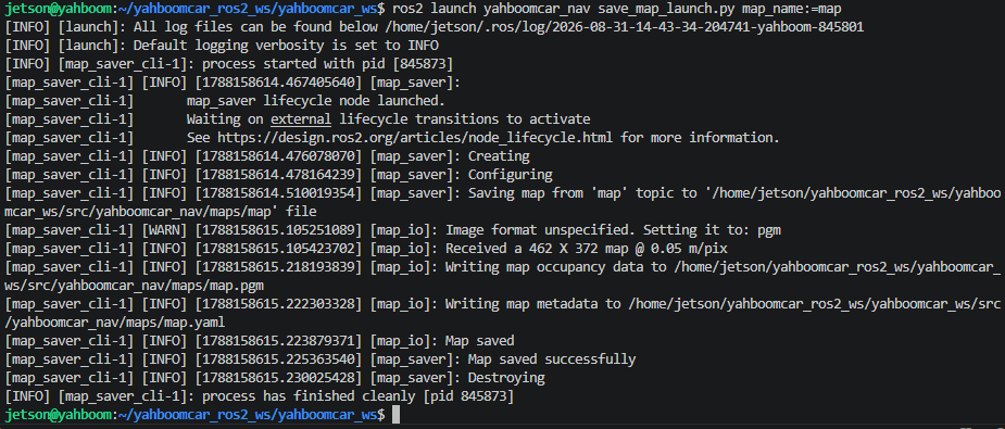
Map files are saved in
~/yahboomcar_ros2_ws/yahboomcar_ws/src/yahboomcar_nav/maps/directory.Save Cartographer Pose Graph File (.pbstream): The pose map (
.pbstream) contains complete graph-optimized pose nodes and original constraint data, which is the required file for subsequent Cartographer pure localization relocalization navigation:Finish current mapping trajectory:
xxxxxxxxxxros2 service call /finish_trajectory cartographer_ros_msgs/srv/FinishTrajectory "{trajectory_id: 0}"Write and save pose graph file:
xxxxxxxxxxros2 service call /write_state cartographer_ros_msgs/srv/WriteState "{filename: '$HOME/yahboomcar_ros2_ws/yahboomcar_ws/src/yahboomcar_nav/maps/map.pbstream'}"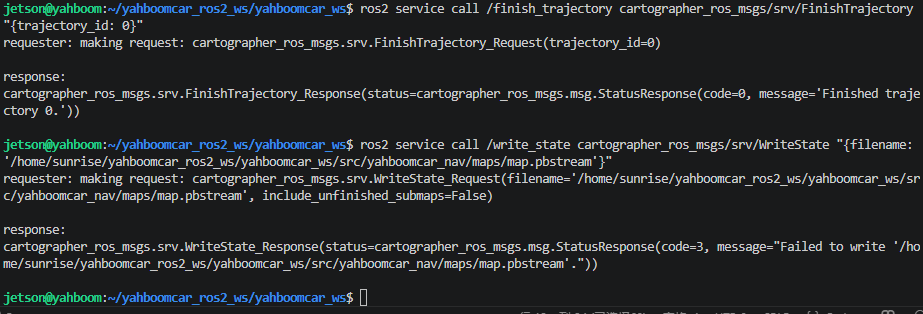
Note
After saving is complete, press Ctrl+C in each terminal to stop the program.
4. Core Source Code and Algorithm Parameter Analysis
4.1 Mapping Launch File Analysis
Launch File Path:
xxxxxxxxxx$HOME/yahboomcar_ros2_ws/yahboomcar_ws/src/yahboomcar_nav/launch/slam/map_cartographer_launch.py
xdef generate_launch_description(): # Introduce chassis and lidar driver laser_bringup_launch = IncludeLaunchDescription(PythonLaunchDescriptionSource( [os.path.join(get_package_share_directory('yahboomcar_nav'), 'launch','robot'), '/laser_bringup_no_odom_launch.py']) )
# Introduce Cartographer SLAM mapping node cartographer_launch = IncludeLaunchDescription(PythonLaunchDescriptionSource( [os.path.join(get_package_share_directory('yahboomcar_nav'), 'launch','slam'), '/cartographer_launch.py']) )
return LaunchDescription([laser_bringup_launch, cartographer_launch])laser_bringup_no_odom_launch.py: Start A1 Pro chassis and lidar driver, avoiding conflicts between external TF and Cartographer's own output TF.cartographer_launch.py: Load Cartographer core nodecartographer_nodeand raster conversion nodeoccupancy_grid_node.
4.2 Cartographer Algorithm Configuration and Core Parameter Interpretation
Configuration File Path:
xxxxxxxxxx$HOME/yahboomcar_ros2_ws/yahboomcar_ws/src/yahboomcar_nav/params/lds_2d.lua
Core Parameter Description Table
| Parameter Name | Current Config Value | Core Function and Physical Meaning |
|---|---|---|
tracking_frame | "base_footprint" | Base coordinate frame Cartographer uses to track robot pose |
published_frame | "base_footprint" | Sub-coordinate frame published by Cartographer (publishes map -> base_footprint) |
provide_odom_frame | true | Whether Cartographer itself provides and publishes odometry TF relationship |
use_odometry | false | Whether to subscribe to external wheel odometry data |
use_online_correlative_scan_matching | true | Enable real-time correlative scan matching (CSM), greatly enhancing front-end matching robustness without prior |
min_range / max_range | 0.1 / 10.0 | Shortest and longest effective filtered distance of lidar for mapping (meters) |
missing_data_ray_length | 0.5 | Distance for inserting no-echo rays into free space (meters) |
constraint_builder.min_score | 0.70 | Loop closure detection minimum matching score threshold, filtering low-confidence incorrect loop matches |
global_localization_min_score | 0.70 | Global relocalization minimum matching score threshold |
Lua Configuration File Core Source
xxxxxxxxxxinclude "map_builder.lua"include "trajectory_builder.lua"
options = {  map_builder = MAP_BUILDER,  trajectory_builder = TRAJECTORY_BUILDER,  map_frame = "map",  tracking_frame = "base_footprint",  published_frame = "base_footprint",  odom_frame = "odom",  provide_odom_frame = true,  publish_frame_projected_to_2d = false,  use_odometry = false,   num_laser_scans = 1,  lookup_transform_timeout_sec = 0.2,  submap_publish_period_sec = 0.3,  pose_publish_period_sec = 5e-3,  trajectory_publish_period_sec = 30e-3,}
MAP_BUILDER.use_trajectory_builder_2d = true
TRAJECTORY_BUILDER_2D.min_range = 0.1TRAJECTORY_BUILDER_2D.max_range = 10.0TRAJECTORY_BUILDER_2D.missing_data_ray_length = 0.5TRAJECTORY_BUILDER_2D.use_imu_data = false TRAJECTORY_BUILDER_2D.use_online_correlative_scan_matching = true TRAJECTORY_BUILDER_2D.motion_filter.max_angle_radians = math.rad(0.1)
-- Ceres loop closure graph optimization matching thresholdPOSE_GRAPH.constraint_builder.min_score = 0.7POSE_GRAPH.constraint_builder.global_localization_min_score = 0.7
return options