Welcome to ROSMASTER A1 PRO repository
13.Synchronous Mapping And Navigation
🗺️ Simultaneous Mapping and Navigation (Synchronous Mapping Navigation)
1. Course Content
Master the integrated working mechanism of "mapping while navigating" (Online SLAM + Nav2) in completely unknown environments.
No need to remotely control the robot to pre-map the area; directly send navigation goal points in unknown environments, and the robot autonomously performs boundary exploration mapping, dynamic path planning, and real-time local obstacle avoidance.
Master the dynamic costmap (Global Costmap) and online SLAM map dynamic linkage update mechanism in synchronous mapping navigation mode.
Master the method for saving 2D occupancy raster map and pose graph (PoseGraph) after exploration mapping is complete.
2. Synchronous Mapping Navigation Principle Analysis and Advantages
In many sudden exploration tasks, detection inspections, or large-scale unknown scenarios, artificially remotely controlling the robot to traverse the entire site for mapping is often impractical. "Simultaneous Mapping & Navigation" deeply integrates online SLAM algorithm with Nav2 autonomous navigation protocol stack:
Cold Start Without Prior: The system starts online SLAM (SLAM-Toolbox) at the robot's current power-on position as origin
(0, 0, 0), real-time outputs initial local map and publishes authoritativemap -> odomTF coordinate transformation.Unknown Area Path Planning (Allow Unknown Planning): By configuring Nav2 global planner (NavfnPlanner) to allow paths through unknown grids (
allow_unknown: true), the robot can directly send navigation goal points to as-yet unexplored unknown gray areas and generate feasible exploration paths.Dynamic Costmap Linkage Refresh (Dynamic Costmap Sync): SLAM node high-frequency publishes the latest occupancy raster map to
/maptopic; the global costmap (Global Costmap) static layer real-time subscribes for updates, dynamically refreshing unknown areas to explored traversable areas or obstacles.Real-time Local Obstacle Avoidance Control (TEB Local Planner): Local planner, based on 235° forward lidar real-time ranging data, dynamically adjusts Ackermann front-wheel steering angle and drive speed, safely avoiding newly discovered obstacles on the travel route.
3. Preparation and Running
This example requires opening 3~4 terminals to start the following nodes in sequence:
3.1 Start Chassis + Lidar
Run in Terminal 1 (start A1 Pro chassis driver, wheel odometry, and lidar driver):
xxxxxxxxxxros2 launch yahboomcar_nav laser_bringup_launch.py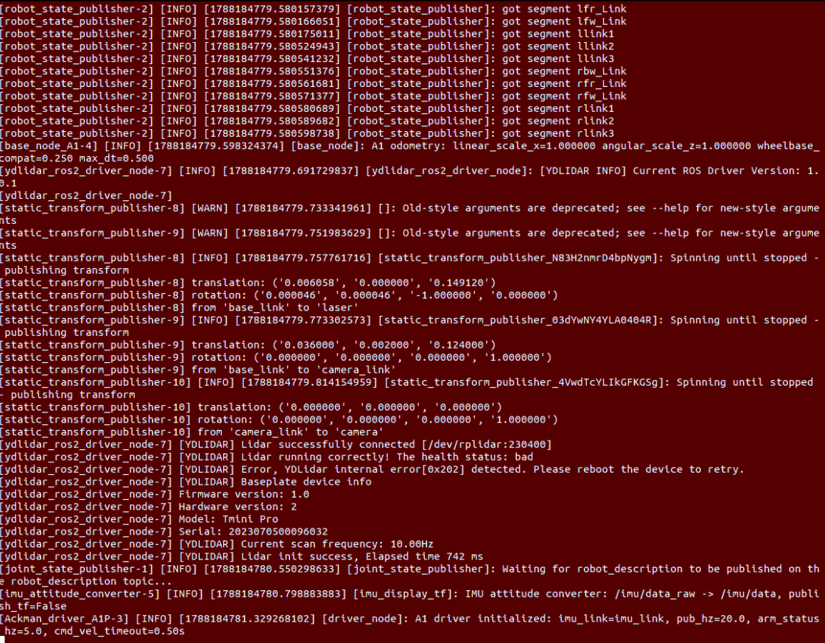
3.2 Start RViz Navigation Visualization
Run in Terminal 2 (it is recommended to open RViz on the virtual machine if the VM and robot are on the same LAN):
xxxxxxxxxxros2 launch yahboomcar_nav display_nav_launch.py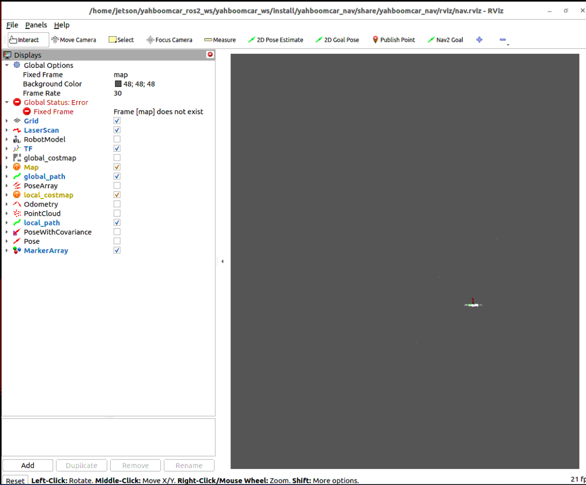
3.3 Start Synchronous Mapping Navigation Core
Run in Terminal 3 with slam:=True to start (one-click pull up online SLAM and Nav2 navigation framework):
xxxxxxxxxxros2 launch yahboomcar_nav navigation_slamtoolx_launch.py slam:=True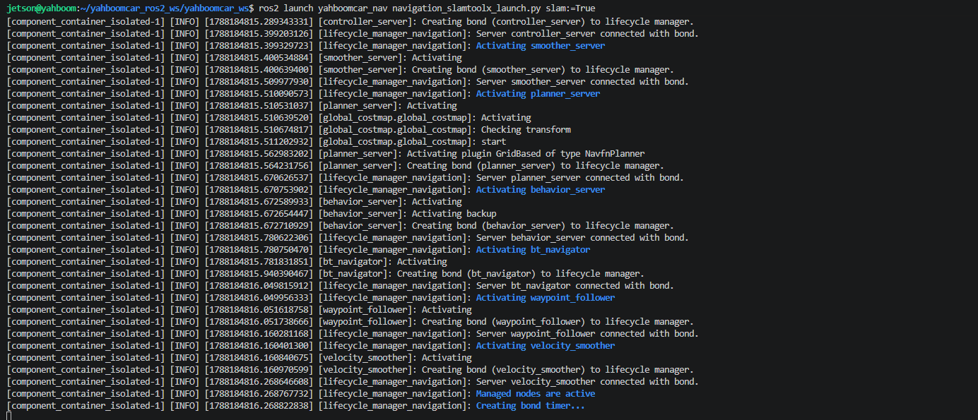
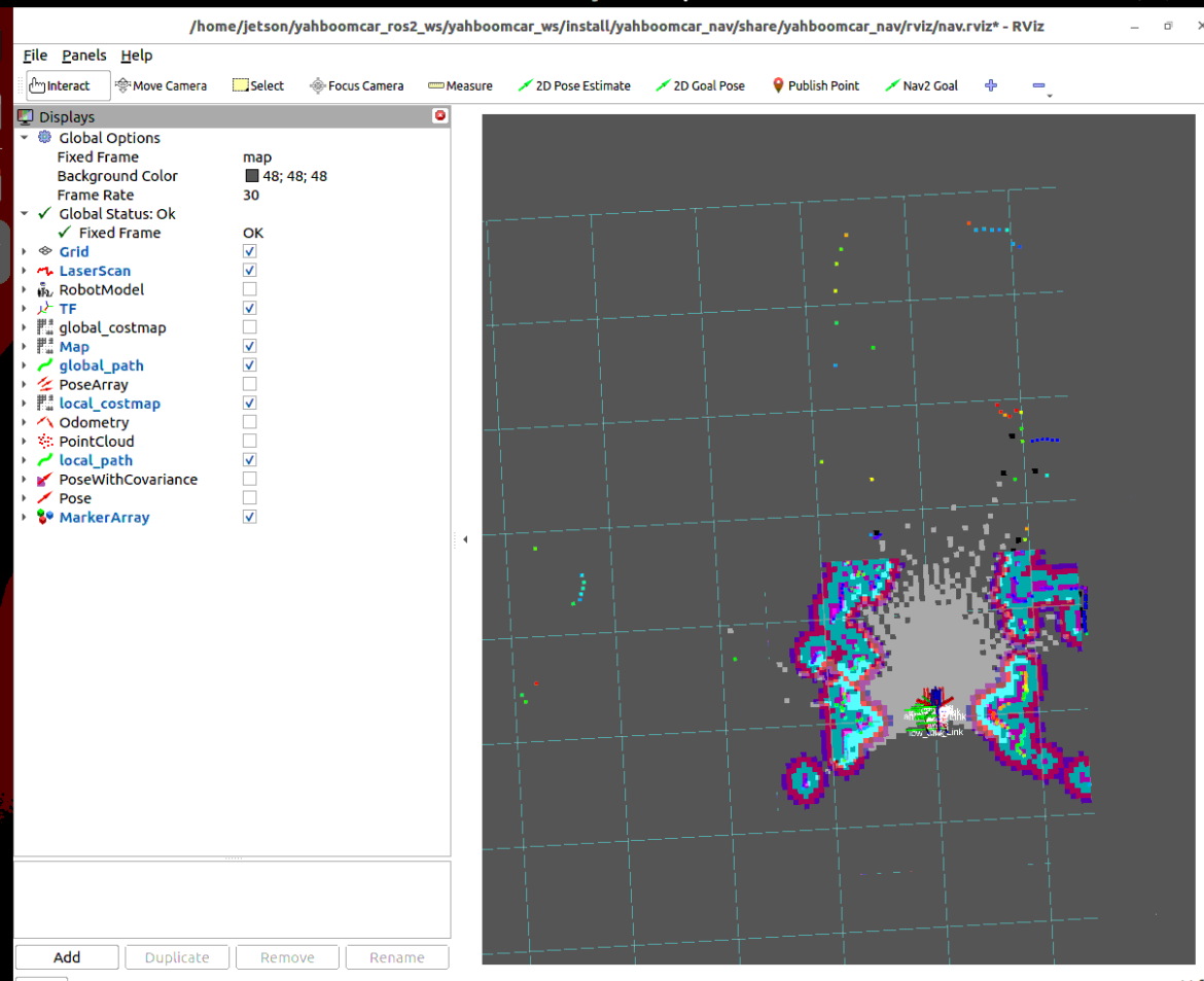
4. Synchronous Mapping Navigation Operation and Map Save Instructions
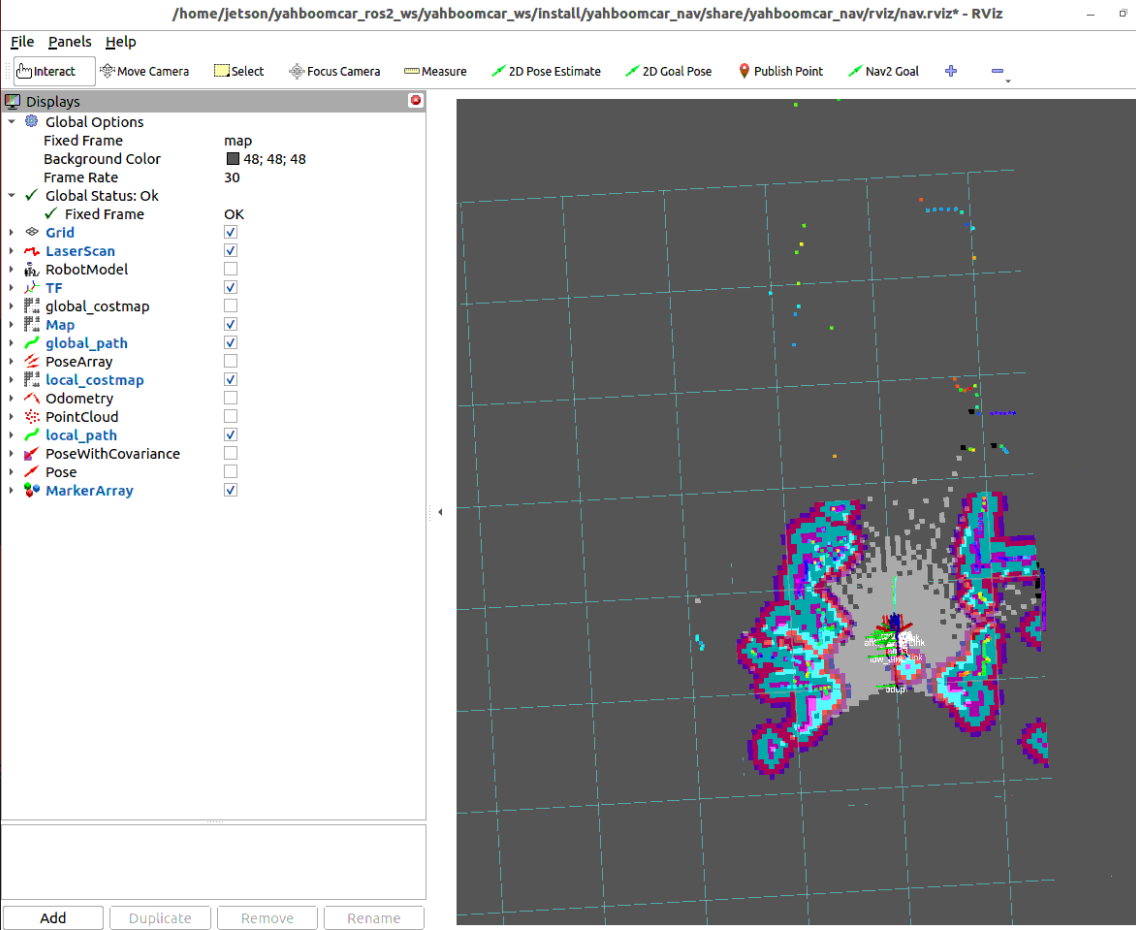
4.1 Send Unknown Area Exploration Goal Point (Nav2 Goal)
Click the
Nav2 Goal(or2D Goal Pose) tool in the top toolbar of RViz2;Click in the unexplored unknown gray area (or current field of view edge) and pull out the expected goal heading arrow;
The global planner will generate an exploration global path passing through known areas and extending into unknown areas.
4.2 Simultaneous Exploration Mapping and Dynamic Obstacle Avoidance Driving
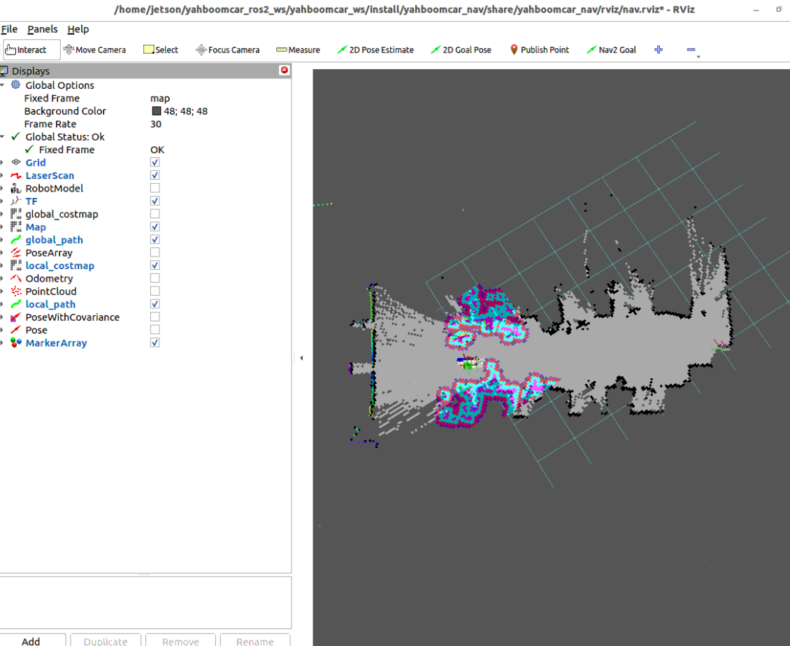
The robot autonomously starts Ackermann front-wheel steering and smoothly moves forward, heading toward the set unknown goal point;
As the robot moves forward, the lidar detection range continuously expands; SLAM algorithm real-time incorporates newly detected walls and traversable areas into the global map;
When encountering unexplored dynamic or static obstacles, the local TEB controller automatically regenerates detouring trajectory, achieving safe exploration.
4.3 Save Exploration Mapping Results
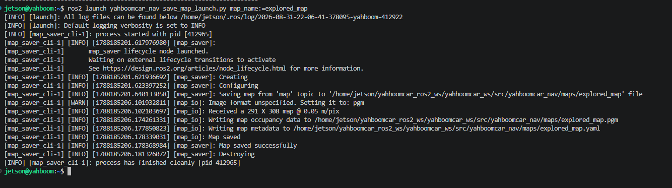
After exploring and completing the target area, run map save commands in Terminal 4:
Save 2D Raster Map (.yaml + .pgm):
xxxxxxxxxxros2 launch yahboomcar_nav save_map_launch.py map_name:=explored_mapSave SLAM Pose Graph (.posegraph + .data):
xxxxxxxxxxros2 launch yahboomcar_nav save_map_launch.py map_type:=posegraph map_name:=explored_map
Note
After exploration mapping and saving are complete, press Ctrl+C in each terminal window to stop the program.
5. Core Source Code and Linkage Mechanism Analysis
5.1 Launch File and SLAM/Nav2 Bridge Analysis
File Path:
xxxxxxxxxx$HOME/yahboomcar_ros2_ws/yahboomcar_ws/src/yahboomcar_nav/launch/nav2/navigation_slamtoolx_launch.py
Key Source Code and Logic Analysis
xxxxxxxxxxdef generate_launch_description():    ...    # Simultaneous mapping and navigation (when slam=True)    nav_and_slam = GroupAction(        condition=IfCondition(PythonExpression(["'", slam, "' == 'True'"])),        actions=[            PushRosNamespace(namespace=namespace),            # Introduce Nav2 standard Bringup Launch and pass slam:=True            IncludeLaunchDescription(                PythonLaunchDescriptionSource(nav2_launch_file),                launch_arguments={                    "map": map_dir,                    "use_sim_time": use_sim_time,                    "params_file": params_file,                    'slam': 'True',                }.items(),            ),            LogInfo(                msg=[Fore.GREEN+'====================Robot Navigation_SLAM Start (Simultaneous Mapping and Navigation)====================', Fore.RESET]            )        ]    )
    return LaunchDescription([        *declared_arguments,        slamtoolbox_localization_nav,        nav_and_slam,    ])
When
slam:=Trueis passed, the system directly callsnav2_bringup'sbringup_launch.pyand activates internalslam_launch.py, pulling up SLAM-Toolbox asynchronous online mapping;At this time, no offline map file needs to be pre-loaded; the SLAM node directly serves as the map publishing source (publishing map to
/maptopic) and global localization provider (publishingmap -> odomTF transformation).
5.2 Core Navigation and Costmap Parameter Interpretation
Parameter Configuration File Path:
xxxxxxxxxx$HOME/yahboomcar_ros2_ws/yahboomcar_ws/src/yahboomcar_nav/params/teb_nav_params.yaml
Core Parameter Description Table
| Parameter Module | Parameter Name | Current Config Value | Core Function and Physical Meaning in Simultaneous Mapping Navigation |
|---|---|---|---|
| Startup Mode | slam | True | Enable simultaneous mapping navigation main switch (automatically start SLAM and bridge Nav2) |
| Global Planner | allow_unknown | true | Core key parameter: Allow planner to pass through unknown areas to generate exploration paths |
| Global Costmap | map_subscribe_transient_local | true | Allow costmap to continuously receive SLAM node dynamic updates and publish latest map |
| Global Costmap | subscribe_to_updates | true | Enable incremental map update subscription, reducing full map transmission bandwidth |
| Local Costmap | rolling_window | true | Local costmap real-time rolling update following robot pose |
| Local Controller | FollowPath.plugin | TebLocalPlannerROS | TEB local time-optimal trajectory optimization planner |
| Local Controller | max_vel_x | 0.25 | Exploration cruising maximum forward linear velocity (m/s) |
| Local Controller | min_vel_x | -0.05 | Strictly limit reverse speed, preventing rear blind zone collision |
| Local Controller | min_obstacle_dist | 0.1 | Minimum safe obstacle avoidance gap between robot outline and obstacles (meters) |
| Local Costmap | inflation_radius | 0.18 | Obstacle dynamic inflation radius (meters) |
Configuration File Core Snippet with Inline Comments
x# 1. Global planner configuration: Allow exploration of unknown areasplanner_server ros__parameters expected_planner_frequency20.0 use_sim_timeFalse planner_plugins"GridBased" GridBased plugin"nav2_navfn_planner/NavfnPlanner" tolerance0.5 use_astarfalse allow_unknowntrue # Must be set to true, otherwise cannot plan paths to unknown areas
# 2. Global costmap configuration: Dynamically subscribe to SLAM online mapglobal_costmap global_costmap ros__parameters global_framemap robot_base_framebase_footprint rolling_windowfalse resolution0.05 plugins"static_layer" "obstacle_layer" "voxel_layer" "inflation_layer" static_layer plugin"nav2_costmap_2d::StaticLayer" map_subscribe_transient_localTrue enabledtrue subscribe_to_updatestrue # Real-time receive SLAM map incremental updates
# 3. Local TEB obstacle avoidance and trajectory optimization configurationcontroller_server ros__parameters FollowPath plugin"teb_local_planner::TebLocalPlannerROS" max_vel_x0.25 min_vel_x-0.05 max_vel_theta1.0 min_obstacle_dist0.1 xy_goal_tolerance0.25 yaw_goal_tolerance0.25