Welcome to ROSMASTER A1 PRO repository
8.Lifelong Mode Mapping
🗺️ SLAM-Toolbox Lifelong Incremental Mapping (Lifelong Mapping)
1. Course Content
Master the core concepts and engineering value of SLAM-Toolbox lifelong mapping (Lifelong / Continuing Mapping).
Master the workflow of loading existing historical pose graph (
.posegraph+.data), performing initial relocalization in RViz, and performing incremental mapping in unknown/changed areas.Master the pose graph smooth docking mechanism based on lidar point cloud gating (Scan Gating).
Master the method for serializing and overwriting saving the latest incremental pose graph and 2D occupancy grid map.
2. SLAM-Toolbox Lifelong Mapping Introduction
In actual robot applications, the operating environment is often not static (for example, warehouse shelf rearrangements, office area expansions, or newly opened operating passages). Traditional 2D SLAM algorithms (such as Gmapping, Cartographer default configuration) mostly belong to Single-Session Mapping; once mapping is completed and a static map is generated, it cannot be directly expanded, and when the environment changes, it often requires completely re-scanning the entire site for mapping, which is extremely costly.
SLAM-Toolbox provides industry-leading Lifelong / Continuing Mapping capability:
Pose Graph Deserialization: At system startup, historical topology graph and original laser scan data are directly loaded through the deserialization service, completely restoring the historical environment in the Ceres graph optimization back-end.
Initial Pose Smooth Docking: Through the point cloud gating interception mechanism, laser data is released only after the robot completes initial alignment via RViz calibration or dock parking, avoiding pollution of the historical map by misaligned laser point clouds.
Incremental Expansion and Global Loop Closure: When the robot explores unknown areas or changed environments, it real-time constructs new pose nodes and local scan buffers; when returning to known areas, it automatically triggers global loop closure detection and relaxation optimization between old and new nodes, generating a higher-precision globally unified map.
3. Preparation and Running
This example requires opening 3~4 terminals to start the following nodes in sequence:
3.1 Start Lifelong Incremental Mapping Node
Run in Terminal 1 (specify loading previously saved map.posegraph and map.data through pose_graph:=map parameter):
ros2 launch yahboomcar_nav map_slam_toolbox_launch.py pose_graph:=map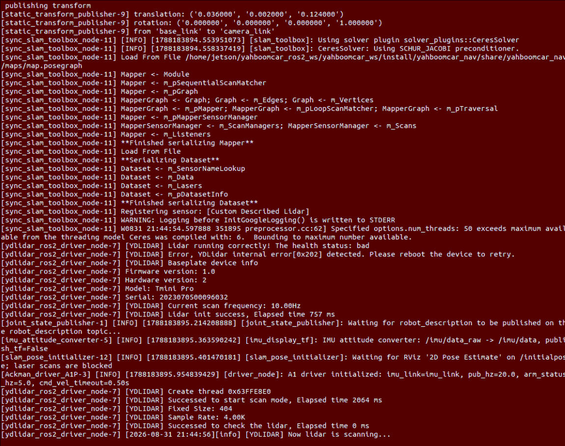
3.2 Start RViz Map Visualization and Initial Pose Alignment
Run in Terminal 2:
xxxxxxxxxxros2 launch yahboomcar_nav display_map_launch.py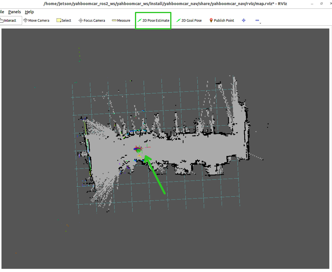
Important
Initial Relocalization Calibration (if the robot is not stopped at the historical map starting origin):
Click the
2D Pose Estimatetool in the top toolbar of RViz2;Click at the actual robot stopping position on the map, and hold and drag the mouse along the chassis heading direction to release the green arrow to publish
/initialpose;After the underlying
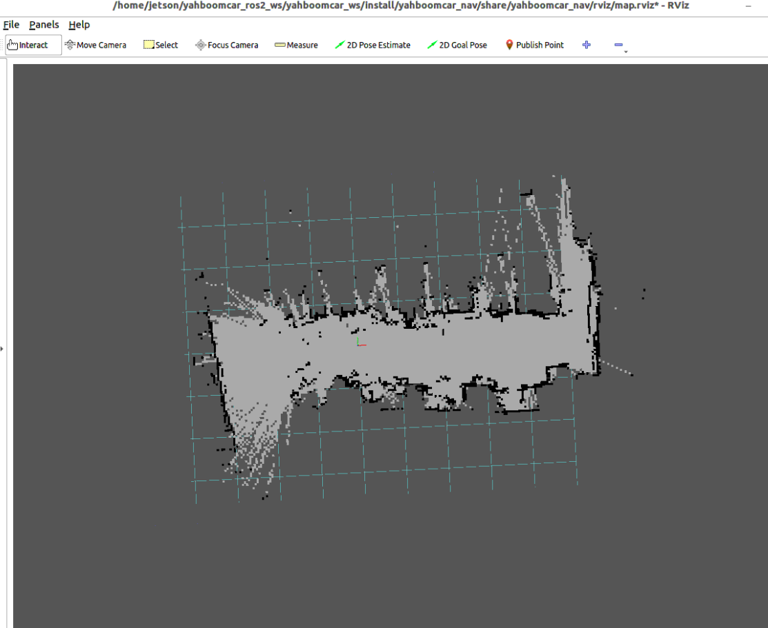
slam_pose_initializernode receives the pose, it will automatically call/slam_toolbox/deserialize_mapservice to align the historical map with the current position, and release the lidar point cloud gating to start incremental mapping.
3.3 Start Keyboard Control to Explore New Areas
Run in Terminal 3 the keyboard control node:
xxxxxxxxxxros2 run yahboomcar_ctrl yahboom_keyboard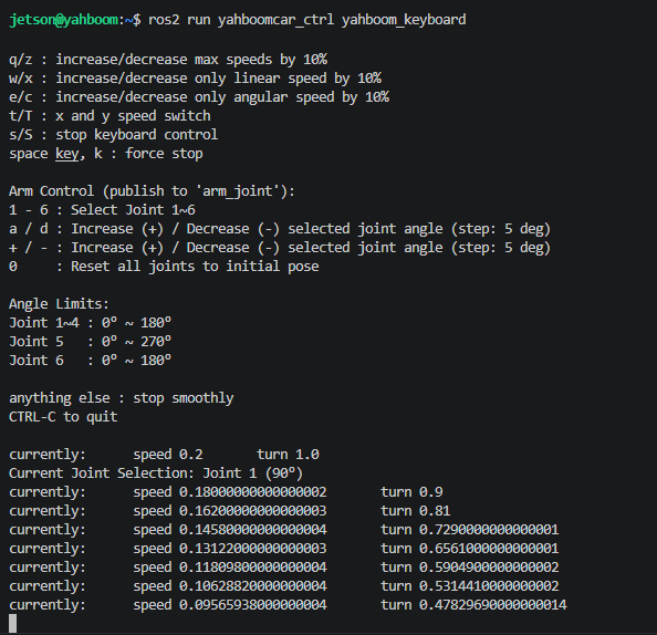
3.4 Incremental Mapping Operation and Map Save Instructions
Explore New Environment and Loop Closure Optimization:
Remote control the robot to slowly and smoothly drive from known areas into unknown expansion areas, observe the seamless splicing of historical map boundaries and new map in RViz.
After exploring new areas, guide the robot back to known areas; the system will automatically match historical features and trigger global loop closure optimization, eliminating long-distance accumulated drift.
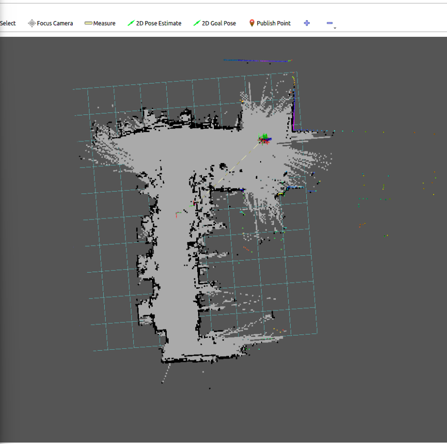
Save Latest Incremental Pose Graph (.posegraph + .data): Run the pose graph save command in Terminal 4 to overwrite and update the pose graph file:
xxxxxxxxxxros2 launch yahboomcar_nav save_map_launch.py map_type:=posegraph map_name:=map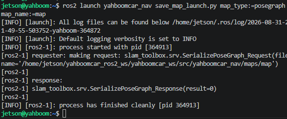
Save Latest 2D Raster Map (.yaml + .pgm): Run the raster map save command to generate the latest raster map for subsequent Nav2 navigation:
xxxxxxxxxxros2 launch yahboomcar_nav save_map_launch.py map_name:=map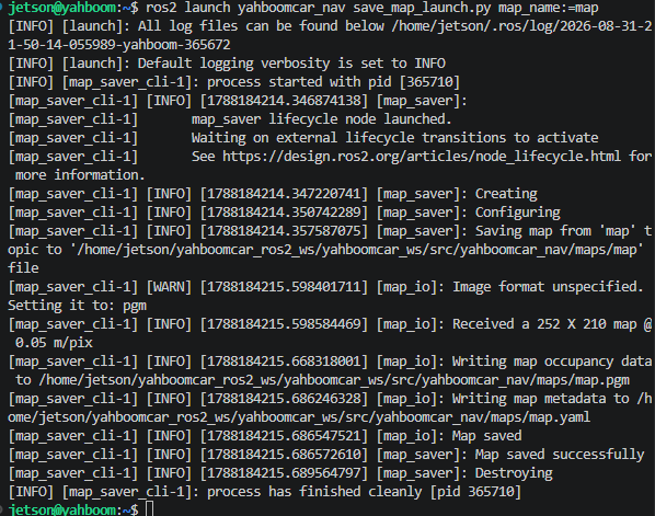
Note
After incremental mapping and saving are complete, press Ctrl+C in each terminal to stop the program.
4. Core Source Code and Algorithm Implementation Mechanism Analysis
4.1 Lifelong Mapping Launch and Scheduling Launch Analysis
Launch File Paths:
xxxxxxxxxx$HOME/yahboomcar_ros2_ws/yahboomcar_ws/src/yahboomcar_nav/launch/slam/map_slam_toolbox_launch.py$HOME/yahboomcar_ros2_ws/yahboomcar_ws/src/yahboomcar_nav/launch/slam/slam_toolbox_wit_launch.py
Launch Scheduling Core Logic
In slam_toolbox_wit_launch.py, the following key scheduling is performed for incremental mapping mode (incoming pose_graph):
xdef _resolve_pose_graph(map_folder_dir, pose_graph): # 1. Automatically verify historical pose graph dual files (.posegraph and .data) existence graph_path = os.path.expanduser(pose_graph) if not os.path.isabs(graph_path): graph_path = os.path.join(map_folder_dir, graph_path)
missing_files = [ path for path in (f"{graph_path}.posegraph", f"{graph_path}.data") if not os.path.isfile(path) ] if missing_files: raise RuntimeError("Cannot continue mapping because pose graph files are missing: " + ", ".join(missing_files)) return graph_path
def _launch_slam_toolbox(context, map_folder_dir, sync_slam_params_file, async_slam_params_file): ... if pose_graph: pose_graph_path = _resolve_pose_graph(map_folder_dir, pose_graph) runtime_parameters["map_file_name"] = pose_graph_path runtime_parameters["map_start_at_dock"] = True if initial_pose_mode == "rviz": # Redirect SLAM node point cloud input to gated and filtered safe topic runtime_parameters["scan_topic"] = "/scan_after_initial_pose"
actions = [ Node( package="slam_toolbox", executable=f"{slam_mode}_slam_toolbox_node", parameters=parameters, name="slam_toolbox", output="screen", ) ]
# When using RViz interactive relocalization, start dedicated pose initializer and point cloud gating node if pose_graph_path and initial_pose_mode == "rviz": actions.append( Node( package="yahboomcar_nav", executable="slam_pose_initializer", name="slam_pose_initializer", output="screen", parameters=[{ "pose_graph": pose_graph_path, "map_frame": "map", "initial_pose_topic": "/initialpose", "scan_input_topic": "/scan", "scan_output_topic": "/scan_after_initial_pose", "deserialize_service": "/slam_toolbox/deserialize_map", }], ) ) return actions4.2 Initial Relocalization and Point Cloud Gating Source Analysis (slam_pose_initializer)
Source Code Path:
xxxxxxxxxx$HOME/yahboomcar_ros2_ws/yahboomcar_ws/src/yahboomcar_nav/yahboomcar_nav/slam_pose_initializer.py
Point Cloud Gating (Scan Gating) and Service Asynchronous Interaction Source
xxxxxxxxxxclass SlamPoseInitializer(Node):    def __init__(self):        super().__init__("slam_pose_initializer")        ...        self._scan_enabled = False       # Lock point cloud gating in initial state        self._request_in_flight = False        self._pending_pose = None
        # 1. Subscribe to original lidar /scan, do not publish to /scan_after_initial_pose when locked        self._scan_publisher = self.create_publisher(LaserScan, scan_output_topic, qos_profile_sensor_data)        self._scan_subscription = self.create_subscription(            LaserScan, scan_input_topic, self._scan_callback, qos_profile_sensor_data        )
        # 2. Subscribe to 2D Pose Estimate initial pose topic published by RViz        self._initial_pose_subscription = self.create_subscription(            PoseWithCovarianceStamped, initial_pose_topic, self._initial_pose_callback, QoSProfile(depth=1)        )
        # 3. Create SLAM-Toolbox pose graph deserialization service client        self._deserialize_client = self.create_client(DeserializePoseGraph, service_name)
    def _scan_callback(self, message):        # Only release lidar data after relocalization alignment is complete        if self._scan_enabled:            self._scan_publisher.publish(message)
    def _initial_pose_callback(self, message):        if self._scan_enabled or self._request_in_flight:            return        ...        # Extract 2D pose (x, y, yaw)        self._pending_pose = (position.x, position.y, yaw)        self._try_initialize()
    def _try_initialize(self):        x, y, yaw = self._pending_pose        request = DeserializePoseGraph.Request()        request.filename = self._pose_graph        request.match_type = request.START_AT_GIVEN_POSE        request.initial_pose.x = x        request.initial_pose.y = y        request.initial_pose.theta = yaw
        # Asynchronously call deserialization service        self._request_in_flight = True        future = self._deserialize_client.call_async(request)        future.add_done_callback(self._initialization_finished)
    def _initialization_finished(self, future):        self._request_in_flight = False        # After deserialization succeeds: enable point cloud gating, unsubscribe from initialpose        self._scan_enabled = True        self.destroy_subscription(self._initial_pose_subscription)        self.get_logger().info("Pose graph initialized at RViz pose; laser scans are now enabled")
Design Highlights
Preventing Historical Map Pollution: If the robot does not start at the historical origin, directly sending lidar point cloud to SLAM-Toolbox will cause current point cloud to be incorrectly matched near the origin, causing serious map distortion. Through the point cloud gating mechanism, mapping only begins after pose alignment succeeds.
Seamless Smooth Docking: After deserialization succeeds, point cloud is immediately released; the entire process does not require restarting the node, completely transparent to upper-level control and visualization.
4.3 Lifelong Mapping Algorithm Core Parameter Interpretation
Configuration File Path:
xxxxxxxxxx$HOME/yahboomcar_ros2_ws/yahboomcar_ws/src/yahboomcar_nav/params/mapper_params_online_sync.yaml
Core Parameter Description Table
| Parameter Name | Current Config Value | Core Role and Physical Meaning in Lifelong Mapping |
|---|---|---|
solver_plugin | CeresSolver | Google Ceres-based nonlinear least squares pose graph optimization back-end |
ceres_loss_function | HuberLoss | Robust kernel function, suppressing distortion from occasional incorrect constraints at old-new area junctions on historical pose graph |
mode | mapping | Mapping working mode (supports continuous new node insertion and graph expansion) |
resolution | 0.05 | Occupancy grid map resolution (0.05 meters/pixel) |
min_laser_range / max_laser_range | 0.1 / 10.0 | Laser effective filtered distance for incremental mapping (meters) |
minimum_travel_distance | 0.1 | Insert new pose graph node when straight-line displacement exceeds 0.1m |
minimum_travel_heading | 0.01745 | Insert new node when rotation displacement exceeds 1°, ensuring dense construction of turns and new area boundaries |
scan_buffer_size | 30 | Sliding window scan buffer capacity, supporting local dense submap construction |
do_loop_closing | true | Enable global loop closure detection, achieving constraint construction and graph optimization relaxation between old and new areas |
loop_search_maximum_distance | 4.0 | Maximum candidate spatial search radius for triggering loop matching (meters) |
loop_match_minimum_chain_size | 12 | Minimum continuous matching chain length for loop closure, ensuring high confidence of old-new map loop closure |
loop_match_minimum_response_fine | 0.55 | Loop fine matching score threshold, filtering low-confidence matches |
distance_variance_penalty | 0.25 | Penalty for displacement variance in weak-feature new areas, improving utilization of chassis odometry prior |
angle_variance_penalty | 0.25 | Penalty for angular variance in weak-feature new areas |